Third Cessna 170A: our last plane: 2000-2003
After I'd finished with the heart valve problem and the FAA and the A.T., we began to think about flying to the year 2000 annual convention of 170 owners that was to be held in Alaska. After looking at 170s for sale in several states in 1999, I paid the FBO at a convenient Maine airport to go with me to inspect a 170 near Pittsburgh. It was rough, with tattered inside fabric and many mouse droppings, and needed many repairs, but the FBO approved my buying it. So I bought it for $21,000. Later it turned out that it was much rougher than it looked, and before selling it in 2003 we spent nearly another $20,000 on it. The weather was bad, so we left the plane and drove home.
Only later did I realize Canadian laws might have prevented us from flying to Alaska. For a USA plane to fly through Canada laws require it be insured for property damage. Many insurance companies will not ensure planes if their owner and pilot has reached the crucial age of 70. I would be 75. Insurers make exceptions if the pilot has a good record, and I had ensured with Avemco since I became part owner of N9776A in 1972.
In March 2000 I returned to Pittsburgh to retrieve the plane. I was 75, and the plane, registered as N3850V, and I were very rusty. I hadn't flown a 170 for 7 years, and hadn't flown anything for nearly 2 years. The previous owner came to the deserted dirt strip to show me a few things, and I took off. The weather deteriorated until I was in IFR, a snow squall. I was using a GPS for the first time, a pilot's portable Garmin 295. I hit its "Nearest" button, and a table of airports in order of proximity appeared, each with important characteristics like length, altitude, and most importantly the compass direction and distance from the plane. I banked towards the first one, Clearfield PA, only 2 miles distant, and landed with half-mile visibility in snow. Two hours later, after I walked to a distant restaurant and the weather improved, I took off again. It was surprised how wild and corrugated the NY-PA border region appeared. I landed for a quick gasoline fill at Oleanta NY then entered New England near Albany just before sunset. The weather was marginal in the Green Mountains of Vermont, but I was able to reach my home base, Wiscasset Maine, in the dusk, turning on the runway lights by clicking the radio.
PS added on 1-15-2015: The serial number of the first Cessna 170A was 18730. Ours was 18737: the 7th produced in a total run of 1522, from 1948 to 1952.

Pilots are encouraged by many FBOs to participate in required annual inspections under supervision of the mechanic. The FBO, who was the mechanic, said in Pittsburgh that it would cost just under $1000 for a list of repairs he gave me. When those repairs were done I was billed $2000 for them. When the engine was warmed and tested, it turned out that some cylinders were bad and a "top overhaul" was needed. The FBO could have detected that in Pittsburgh by warming the engine and "pulling the prop through" but did not. When I asked why he hadn't, he said "I knew you wanted to buy the plane anyway". Of course the opposite is true, for otherwise I would not have paid him a few hundred dollars to tell me if the plane were worth buying. Expensive surprises turned up soon after I got the plane to Maine, continuing with defects which could have killed my wife and I, but only cost us another ten grand or so.
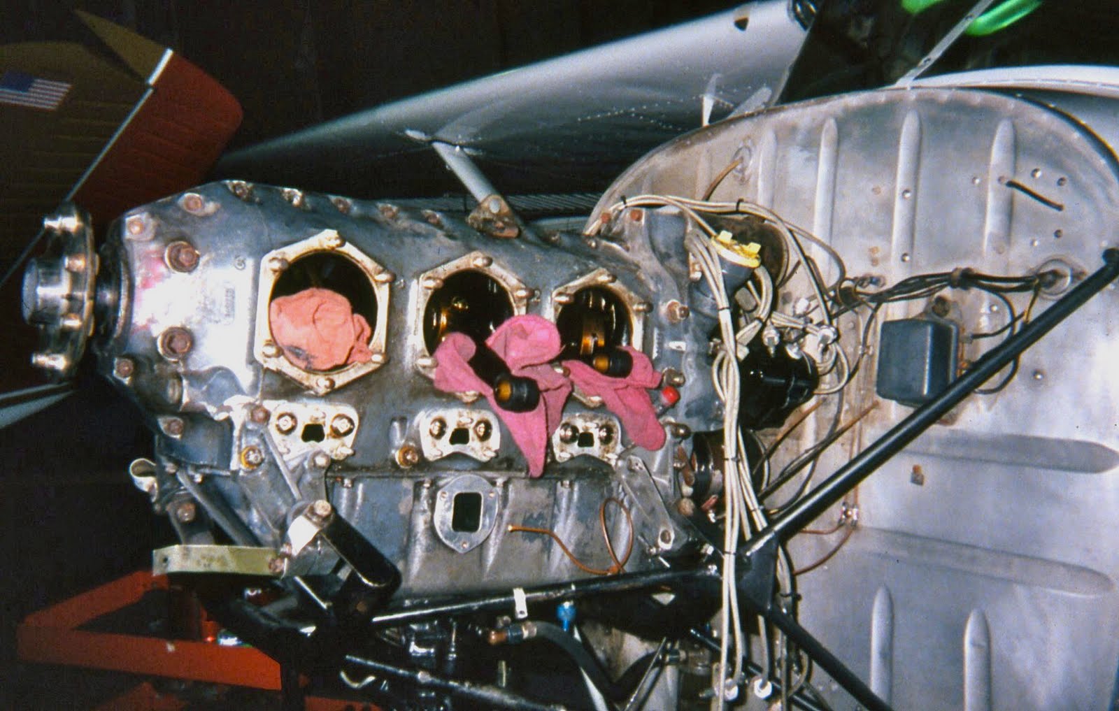
I vacuumed years of dirt and dung from hidden niches, bought a kit and replaced the ratty headliner, installed new carpeting and insulation, painted the cockpit metal white, had the seats reupholstered, found solid axles in Canada to replace the vulnerable hollow originals, had the transponder replaced in Bar Harbor, fixed a broken door latch, more. Note the pictured engine parts before and after I sandblasted them. Everything was made as near new as my sweat and our dollars could make them, except the battery, which the FBO said was good. It turned out the battery should have been replaced several years earlier.
PS added on 1-15-2015: The serial number of the first Cessna 170A was 18730. Ours was 18737: the 7th produced in a total run of 1522, from 1948 to 1952.
Pilots are encouraged by many FBOs to participate in required annual inspections under supervision of the mechanic. The FBO, who was the mechanic, said in Pittsburgh that it would cost just under $1000 for a list of repairs he gave me. When those repairs were done I was billed $2000 for them. When the engine was warmed and tested, it turned out that some cylinders were bad and a "top overhaul" was needed. The FBO could have detected that in Pittsburgh by warming the engine and "pulling the prop through" but did not. When I asked why he hadn't, he said "I knew you wanted to buy the plane anyway". Of course the opposite is true, for otherwise I would not have paid him a few hundred dollars to tell me if the plane were worth buying. Expensive surprises turned up soon after I got the plane to Maine, continuing with defects which could have killed my wife and I, but only cost us another ten grand or so.
I vacuumed years of dirt and dung from hidden niches, bought a kit and replaced the ratty headliner, installed new carpeting and insulation, painted the cockpit metal white, had the seats reupholstered, found solid axles in Canada to replace the vulnerable hollow originals, had the transponder replaced in Bar Harbor, fixed a broken door latch, more. Note the pictured engine parts before and after I sandblasted them. Everything was made as near new as my sweat and our dollars could make them, except the battery, which the FBO said was good. It turned out the battery should have been replaced several years earlier.


Notice the pistons etc. before and after I sandblasted them.


Our first gasoline-and-pit stop was at Northhampton, Massachusetts. There we happened on Roger Atwood, who had taught me to fly just 50 years earlier. At 79 he was still teaching flying and ferrying planes. He had met Lindbergh, knew Anne Morrow (later Lindbergh), Amelia Earhart, Pancho Barnes, and Howard Hughes. He taught the King of Jordan to fly when Abdullah was a student at nearby Deerfield Academy.

We headed for the "Hudson River Corridor", a tube of allowable airspace for small planes beside Manhattan. The pilot must stay under 1100', stay over the bridges, stay away from the NJ and NY shores. The corridor relies on informal common sense, and is still allowable even after the 9/11 disaster. Marge had been reluctant. It was awesome.

We rode our flying carpet down the river, looking up at skyscrapers, and the World Trade Towers a year before their destruction.

When we arrived at the Statue of Liberty Marge said, "I want to do that again !".

However, we turned right at the Verrezano Narrows bridge and headed for Colorado, where my daughter and family lived. What's this, a wastewater purification labyrinth ?
We landed for the night at Johnstown, PA, site of a famous and disastrous flood a century before.
May 30: This second day of the trip did not go well. My cold was worse. When I made the initial ground check of the engine I found a few strands of grass, which led to a bird nest built the previous night, which would have caught fire in flight had I not removed it. We flew to Parkersburg in the West Virginia panhandle, where we found unpleasant controllers and ground personnel, and incompetent mechanics. The rear tire noisily went flat on landing. and was "fixed" for $30. The battery was dead after lunch, so I had to hand-prop the engine. That's difficult and hazardous, and was to be repeated often on the trip. Asked for help, the mechanics just stared at the engine. I suggested a new fuse. They inserted one too small, unsuccessfully, and went off to phone about expensive repairs. I found and installed a proper fuse, hand-propped the engine and we continued onward. When the wonderful new GPS started to fail in flight, I found in flight another fuse the mechanics had left uninstalled, so I immediately installed it to fix that problem. At our motel in Louisville we ate the worst restaurant supper I could remember since that English bus stop. The day temperature peaked at 92 degrees.
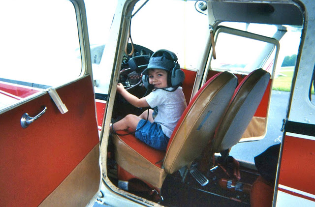

By coincidence Marge's son Phil, his wife Anne, and son Danny were visiting Louisville. Danny got a kick out of "flying " the plane. How time flies. Danny now has a PhD in Maryland.

Third day: On taxiing for takeoff the rear tire was flat again. For $80 the plane was towed to the hangar and a new tire installed.
We made about our longest hop ever, 400 miles to Booneville, Missouri. We put 32 gallons in our 37 gallon tanks !! The little FBO was friendly, the auto gas was cheap, and we took their courtesy clunker to a motel. Most airports we used had a free courtesy car, a vehicle somewhat shabbier than those on inhabited Maine islands. Next morning one of the car tires was flat.
Fourth day, June 1: Strong headwinds reduced our ground speed to 79 mph, per the GPS. Cars on the Interstate beneath us were passing us, so we landed early, at Lee's Summit, MO, where the very friendly FBO let us use their special power equipment to wash off 4 days of grime from our plane.


President Truman's desk, where the buck stopped.
The ground was rising ever higher as we crossed Kansas and approached Denver. Our GPS was extremely helpful in traversing the complicated 3-dimensional airspace restrictions around the sprawling city. The screen displayed a colored moving map showing our plane in precise relation to our planned route and the many prohibited flight areas around that city. We buzzed the home of daughter Carol and family in suburban Erie at minimum legal altitude, but they didn't hear us, so we landed and phoned them.
After 4 1/2 days in Erie it was time to go northward. We planned to start early before heat built up for our takeoff at 5000'+ altitude, but were delayed over an hour, so it got pretty hot. A year earlier a small plane took off in similar conditions there, could not climb, and the crash killed all 4 on board. After takeoff I struggled to maintain enough altitude, until after 5 miles I could safely reverse direction to fly northward.

We made about our longest hop ever, 400 miles to Booneville, Missouri. We put 32 gallons in our 37 gallon tanks !! The little FBO was friendly, the auto gas was cheap, and we took their courtesy clunker to a motel. Most airports we used had a free courtesy car, a vehicle somewhat shabbier than those on inhabited Maine islands. Next morning one of the car tires was flat.
Fourth day, June 1: Strong headwinds reduced our ground speed to 79 mph, per the GPS. Cars on the Interstate beneath us were passing us, so we landed early, at Lee's Summit, MO, where the very friendly FBO let us use their special power equipment to wash off 4 days of grime from our plane.

We rented a car and visited Harry Truman's home in Independence, Missouri, a National Monument. There was only one person space left for the tour, but a lady who lived in the area gave up her reservation so we could both go. That's Marge's black pocketbook. We ate too well at the Apple Farm restaurant.

President Truman's desk, where the buck stopped.
The ground was rising ever higher as we crossed Kansas and approached Denver. Our GPS was extremely helpful in traversing the complicated 3-dimensional airspace restrictions around the sprawling city. The screen displayed a colored moving map showing our plane in precise relation to our planned route and the many prohibited flight areas around that city. We buzzed the home of daughter Carol and family in suburban Erie at minimum legal altitude, but they didn't hear us, so we landed and phoned them.
After 4 1/2 days in Erie it was time to go northward. We planned to start early before heat built up for our takeoff at 5000'+ altitude, but were delayed over an hour, so it got pretty hot. A year earlier a small plane took off in similar conditions there, could not climb, and the crash killed all 4 on board. After takeoff I struggled to maintain enough altitude, until after 5 miles I could safely reverse direction to fly northward.

As we followed the Rocky Mountains on our left, the ground under us gradually rose to over 8,000' in the badlands of Wyoming.

We followed I-25 northward for a while. Here "IFR" means "I Follow Interstate".
We landed at the nearly deserted airport in Buffalo, Wyoming. We drove the airport courtesy car to the "downtown" combination car dealership and car rental agency to rent a better car. There was nobody there, so we sat and waited. Then occurred another example of the kindnesses we have found at small airports and small towns. The dealer arrived, said he had no rentals available, "..but you can use that Buick on the lot over there. Just replace the gasoline before you return it. You don't have to bring it here: leave it at the airport tomorrow". So we drove 200 miles around the Big Horn Mountains, and flew onward the next day.
We were flying in a strong crosswind toward what wind maps ( click here) show as the windiest area of North America, around Shelby, Montana. We stayed 3 nights there, while gales continued unabated. We drove a rented car through Glacier National Park. We found coffee in Montana is uniformly weak, we suppose because the pioneers had to stretch their resources and the tradition persists. One day a hailstorm left the summer ground looking like a snowy winter, and made little permanent pockmarks in the aluminum skin of our plane. The FBO assured us that their local winds are different than those over the eastern flatlands. Eastern winds, he said, are turbulent because fast air moves into still air and the conflict causes turbulence. He said Montana winds blow all the time, so the air just flows steadily without much tumbling. We had to believe him if we were ever to leave Shelby, so on the third day we flew to nearby Canada in winds over 30 mph, which increased with altitude.
As we entered the pattern at Lethbridge, Alberta, we understood why the city proudly claims it is the windiest in Canada. To stay in the landing pattern, sometimes the plane pointed about 45 degrees away from the direction it travelled. On the ground I had to run the engine at high speed and hold the rudder full over, to be able to taxi in an approximate straight line. We were able to get to a tiedown only because an airport worker pushed sideways on the rear fuselage as we moved off the taxiway. The next plane to land lit like a seagull, with no forward speed, its wheels not turning on the pavement until its engine was revved up for taxiing. We found we had landed in winds of 35 mph gusting to 45, increasing to 60 soon after. In winds that strong a plane can leave the ground on its own unless it is tied down.
The next day we flew to Rocky Mountain House, dodging IFR conditions. When we returned with the airport courtesy car the next morning, I had to replace a blown-out main fuse in our plane again, and because the battery was flat again, had to hand-prop it on wet pavement, an unpleasant and potentially dangerous action. The engine starts at a relatively slow 1200 rpm (half the 2400 rpm when flying), or 20 rotations per second. With 2 blades, that means one has 1/40 of a second to swing his hands out of the way before they are sliced off. I continued to occasionally replace the main fuse and hand prop the engine, because of things not done by the Maine mechanic that should have been done, after no expense had been spared to make the plane safe for the journey. Note: Propeller tips travel at about the speed of sound, which accounts for their roar.
We spent the next 2 nights at Fort St. John, British Columbia, until the weather improved. We were treated like royalty by the FBO and the Ramada Inn people in that pleasant little town. It's on the Alaska HIghway ("the Highway"), which was crudely built in 1942 and steadily improved ever since. That road is like a 1380 mile emergency landing strip, because car traffic is light, there are no adjacent utility poles, and trees are cut way back on both sides so wild animals won't suddenly appear on the road. However, it's not straight, and pilots take short cuts, like our next hop, to Fort Nelson.
June 16: We left in CAVU (Ceiling And Visibility Unlimited) conditions. The wheat fields and brilliant yellow canola fields had been left behind, replaced by forest broken only by an occasional oil well service road or logging road. I was grateful for our GPS, which supplemented our paper charts. At one point it showed the nearest airport was 70 miles away. The Fort Nelson FBO was as friendly as we had heard. An American flag was flying, and in the tiny restaurant all-homemade food was served by a friendly old lady, who was the entire staff. We took off on the alternate grass runway (easier on tires) and entered the first true total wilderness we had ever seen, stretching to the horizons. We intersected Toad River, followed that to the Grand Canyon of the Liard, and stayed in sight of that river until we reached the Highway again. Meanwhile there was not a single logging road, only corrugated forest with canyons and snowy mountains: astoundingly beautiful conditions enhanced by our adrenaline. The only place for an emergency landing was an occasional sandbar on the mostly turbulent Liard River. When we were near Hell's Canyon and the Rapids of the Damned, names to stir the adrenaline, I smelled gasoline, and looked up to see the front of the headliner dark with fuel. We were in a cubicle in the worst place to be faced with possible fire or fuel exhaustion.
 We landed at Watson Lake, Yukon Territory, and went to the huge hangar built in 1941, before the Highway was started. Its construction was a phenomenal feat of logistics, transporting materials by barge from Seattle to the mouth of the Taku River, then by truck over river ice and an ice road through mountains to Watson Lake. The airport was a key point in the Northwest Staging Route of World War II, by which planes were flown from the USA to Alaska to Siberia to the Russian front in Europe.
The hangar seemed to have lots of bush planes, vintage planes, and modern planes, but no people. In a back room we found 2 mechanics, brothers whose demeanor had earned them the nicknames of Doom and Gloom. Doom went to our plane to assess our problem. After I reluctantly peeled back part of the new headliner, he found that hose clamps fastening two small rubber gasoline-vent hoses to copper pipes were oversize, so were not as tight as they looked. I'd installed them in Maine, under the direction and approval of the mechanic. Turbulence had bounced some gasoline up into those vents, and out through the defective joint. We got a ride to town, where I bought smaller hose clamps, which I installed before our next hop.
Watson Lake is famous for its Sign Post Forest, which now includes the sign we posted in 2004, on our second trip to Alaska by Toyota. I made the sign wrong: the first car trip was by the Toyota Camry we eventually left in Panama, and the second car trip was by Toyota Corolla. In case you go there: the sign is close to the Sign Post Forest office.


We landed at the nearly deserted airport in Buffalo, Wyoming. We drove the airport courtesy car to the "downtown" combination car dealership and car rental agency to rent a better car. There was nobody there, so we sat and waited. Then occurred another example of the kindnesses we have found at small airports and small towns. The dealer arrived, said he had no rentals available, "..but you can use that Buick on the lot over there. Just replace the gasoline before you return it. You don't have to bring it here: leave it at the airport tomorrow". So we drove 200 miles around the Big Horn Mountains, and flew onward the next day.
We were flying in a strong crosswind toward what wind maps ( click here) show as the windiest area of North America, around Shelby, Montana. We stayed 3 nights there, while gales continued unabated. We drove a rented car through Glacier National Park. We found coffee in Montana is uniformly weak, we suppose because the pioneers had to stretch their resources and the tradition persists. One day a hailstorm left the summer ground looking like a snowy winter, and made little permanent pockmarks in the aluminum skin of our plane. The FBO assured us that their local winds are different than those over the eastern flatlands. Eastern winds, he said, are turbulent because fast air moves into still air and the conflict causes turbulence. He said Montana winds blow all the time, so the air just flows steadily without much tumbling. We had to believe him if we were ever to leave Shelby, so on the third day we flew to nearby Canada in winds over 30 mph, which increased with altitude.
As we entered the pattern at Lethbridge, Alberta, we understood why the city proudly claims it is the windiest in Canada. To stay in the landing pattern, sometimes the plane pointed about 45 degrees away from the direction it travelled. On the ground I had to run the engine at high speed and hold the rudder full over, to be able to taxi in an approximate straight line. We were able to get to a tiedown only because an airport worker pushed sideways on the rear fuselage as we moved off the taxiway. The next plane to land lit like a seagull, with no forward speed, its wheels not turning on the pavement until its engine was revved up for taxiing. We found we had landed in winds of 35 mph gusting to 45, increasing to 60 soon after. In winds that strong a plane can leave the ground on its own unless it is tied down.
The next day we flew to Rocky Mountain House, dodging IFR conditions. When we returned with the airport courtesy car the next morning, I had to replace a blown-out main fuse in our plane again, and because the battery was flat again, had to hand-prop it on wet pavement, an unpleasant and potentially dangerous action. The engine starts at a relatively slow 1200 rpm (half the 2400 rpm when flying), or 20 rotations per second. With 2 blades, that means one has 1/40 of a second to swing his hands out of the way before they are sliced off. I continued to occasionally replace the main fuse and hand prop the engine, because of things not done by the Maine mechanic that should have been done, after no expense had been spared to make the plane safe for the journey. Note: Propeller tips travel at about the speed of sound, which accounts for their roar.
We spent the next 2 nights at Fort St. John, British Columbia, until the weather improved. We were treated like royalty by the FBO and the Ramada Inn people in that pleasant little town. It's on the Alaska HIghway ("the Highway"), which was crudely built in 1942 and steadily improved ever since. That road is like a 1380 mile emergency landing strip, because car traffic is light, there are no adjacent utility poles, and trees are cut way back on both sides so wild animals won't suddenly appear on the road. However, it's not straight, and pilots take short cuts, like our next hop, to Fort Nelson.
June 16: We left in CAVU (Ceiling And Visibility Unlimited) conditions. The wheat fields and brilliant yellow canola fields had been left behind, replaced by forest broken only by an occasional oil well service road or logging road. I was grateful for our GPS, which supplemented our paper charts. At one point it showed the nearest airport was 70 miles away. The Fort Nelson FBO was as friendly as we had heard. An American flag was flying, and in the tiny restaurant all-homemade food was served by a friendly old lady, who was the entire staff. We took off on the alternate grass runway (easier on tires) and entered the first true total wilderness we had ever seen, stretching to the horizons. We intersected Toad River, followed that to the Grand Canyon of the Liard, and stayed in sight of that river until we reached the Highway again. Meanwhile there was not a single logging road, only corrugated forest with canyons and snowy mountains: astoundingly beautiful conditions enhanced by our adrenaline. The only place for an emergency landing was an occasional sandbar on the mostly turbulent Liard River. When we were near Hell's Canyon and the Rapids of the Damned, names to stir the adrenaline, I smelled gasoline, and looked up to see the front of the headliner dark with fuel. We were in a cubicle in the worst place to be faced with possible fire or fuel exhaustion.

The hangar seemed to have lots of bush planes, vintage planes, and modern planes, but no people. In a back room we found 2 mechanics, brothers whose demeanor had earned them the nicknames of Doom and Gloom. Doom went to our plane to assess our problem. After I reluctantly peeled back part of the new headliner, he found that hose clamps fastening two small rubber gasoline-vent hoses to copper pipes were oversize, so were not as tight as they looked. I'd installed them in Maine, under the direction and approval of the mechanic. Turbulence had bounced some gasoline up into those vents, and out through the defective joint. We got a ride to town, where I bought smaller hose clamps, which I installed before our next hop.
Watson Lake is famous for its Sign Post Forest, which now includes the sign we posted in 2004, on our second trip to Alaska by Toyota. I made the sign wrong: the first car trip was by the Toyota Camry we eventually left in Panama, and the second car trip was by Toyota Corolla. In case you go there: the sign is close to the Sign Post Forest office.


In town I accidentally bent my glasses, and went to a garage to borrow pliers to fix them. I got them from a Belgian couple who were having their 1955 Jaguar coupe serviced (#53). It had strange markings, including "Around The World In 80 Days". I have an Amazon book on this entitled "A Lap of the Globe: Behind the Wheel of Vintage Mercedes in the Worlds's Longest Auto Race: (click). Essentials: Forty cars made before 1960 and 4 support vehicles, and their owners who had paid an entrance fee of about $100,000, were on schedule to go around the world in 80 days. So our paths met there. They had driven from Europe across Siberia to Beijing, where the cars flew in the world's biggest cargo plane, a Russian behemoth, and the people flew in a chartered jet, to Anchorage, where they continued down the Highway. We enjoyed supper with the Jaguar owner and his wife.
PS: 4-4-2022: That Antonov plane, the world's biggest in size and carrying capacity, was in Ukraine for servicing, but was destroyed yesterday by Russian invaders.

June 18: Our route from there to Whitehorse, capital of Yukon Territory, was, after much thought, the most stupendous we had flown in our lives. We stayed in sight of the (Alaska) Highway all the way, Visibility was excellent, but several times we went through "virga", which is light snow that evaporates before it reaches the ground.


This is the Teslin airstrip at Teslin village on the Alaska Highway on Teslin Lake, 70 miles long. We followed the Highway beside the lake all its length.
The Whitehorse FBO had four $30 rooms for transient pilots, so we rented one which overlooked our Cessna. This was the busiest air hub we had ever used, with jets coming in from all over, and a busy terminal. At its restaurant the waitress heard how we were travelling and said we could use her car the rest of her shift, but we declined with thanks.
We left there June 19 for the 300 miles to the Indian village of Northway, Alaska, where we would go through Customs. We couldn't land enroute, because there were no gas stations, and pilots must stick to the flight plans required in Canada. The friendly weatherman predicted headwinds, turbulence and mountain clouds. "Headwinds ?", he said, "It's a law in Canada". Instead we had a tailwind, relatively smooth air, and CAVU (Ceiling And Visibility Unlimited) most of the way.

The scenery was "utterly utterly awesome" per our flight diary, as we crossed and followed Kluane Lake for nearly 50 miles, with the snow-capped St. Elias Mountains, Canada's highest, rising steeply on our left, its many glaciers stretching out toward us. We stayed at 5000' elevation within 10 miles of the highway. If the motor quit we could glide that far.The navigation was simple: just follow the Highway, here crossed by a glacial outwash.

The yellow area beside the Highway is a mining site. Flight Service warns pilots if there will be blasting, so they can stay at least 3000' aloft to avoid flying stones. Stopped traffic can be another indicator, easily visible from aloft. That's not dependable, because there might be no traffic to stop.

The Highway gradually gets nearer the St. Elias Mountains, which on the Alaska side of the border are a National Park.


The Highway gradually gets nearer the St. Elias Mountains, which on the Alaska side of the border are a National Park.

We had been told the Northway customs agent was one of the most unfriendly of many such USA agents. However, he had been replaced by the exact opposite. He said, "Go relax in the restaurant while I do the paperwork. Ask them to save a piece of their great pie for me".
We filed a flight plan for Chicken , with whose postmaster we had corresponded since we visited there by car from Maine in 1996. Chicken has a short (2500') dirt strip with a sharply rising slope at one end, so we had to land downwind (not good), with the runway out of sight on the base leg, until we turned over the river on short final. Notice the hill that blocked view of the runway on base leg (on left in photo) . Chicken is right of the runway. I radioed, "Chicken Unicom, this is November 3-8-5-0 Victor. What are your winds?" We were amazed by the reply, "I'm at the postoffice. I'll go outside and look". I didn't expect a control tower, but... postoffice...? I replied, "Robin, this is Dick and Marge from Maine". She may have figured that the old couple who said in 1996 that they'd return, never would. We've corresponded ever since.
This is Chicken, population 37, with no phones or indoor plumbing. There in 1996 we had met Robin Hammond, postmaster, who persuasively explained that the post office is the heart of Chicken. She told us that without enough stamp sales the post office would close, and eliminate the year round delivery of supplies by mail, and ski plane when the road is closed by snow. Similarly, some Maine island communities have died when schools close, although in Chicken the few students are home schooled, quite successfully. She said we could buy our stamps from her at no extra cost by using free USPS envelopes she supplied. Ever since we've bought our stamps from Robin in $50 increments. So can you, by writing Postmaster, Chicken AK 99732. Robin and her 2 teenage daughters were travelling in Egypt when we were there on this trip. Her husband is a gold miner.


We walked a half mile to "Beautiful Downtown Chicken", known for its lack of inside plumbing (like Marge grew up with). The friendly bar owner, whose father had been a patient of Marge at Togus, drove us to a woods construction site, where with difficulty we contacted FAA to close our flight plan, so they wouldn't come looking for us. We visited Robin for an hour. She said it was good we'd walked up on the road instead of the shorter path, because the previous week a neighbor had to take refuge in a shed on the path when a grizzly bear threatened.
June 20 we flew to Fairbanks, at 65 degrees latitude our furthest north in a little plane. It was the longest daylight of the year. Since it is a little south of the Arctic Circle it was less bright at midnight, but not by much. The airport had 4 parallel strips: 11800' long for big planes, 3100' long for the hundreds of the mostly taildraggers based there, a long basin for float planes, and a strip for ski planes in the winter. On final for landing we were diverted from the long runway to the 3100' one.

I still have (9/9/22) the strips and damaged filter shown, which the mechanic obviously missed and could have caused a disaster on our wilderness flight.
The weather was deteriorating, and was marginal as we flew over 60 miles of roadless forest to Tok, back on the Highway. That day's Cessna problem was the tail wheel shimmying violently on landing. I fixed that by shortening its control chains. Tok has no municipal, sales, real estate or state income taxes. That leaves Federal income taxes, but some just don't bother with that, we were told.
We didn't make any reservations even in this busy tourist season, because we had no schedule. So it was a scramble to find a B&B, way out of town. Like all USA BBs we've used, it was not as good as nearly all the Canadian B&Bs we've used.
We had 3 interesting days there. We went on a river boat tour conducted by 2 cheerful pretty girls, one Indian and one who said she wanted to be the first Eskimo astronaut. We attended a boisterous Solstice fair, where Marge almost lost her pocketbook to an Indian on a bicycle.
We flew south from Fairbanks in view of Mt. McKinley (Denali) through spectacular Windy Pass, famous for living up to its name, to Talkeetna. Its airport is the center for those going to climb Denali, and for sightseeing planes. We had hired one in 1996 to fly around the mountain, and remember one place where I could only say, "Good God", with a lump in my throat, to which the pilot replied, "Everybody says that at this point". There was no plane there then equipped to fly over the top, which we thought would be more beautiful. This time there was such a plane, but it was not more beautiful, because we came to realize it's better to fly near the scenery than over it like an airliner. Nevertheless it was thrilling to look down on the summit, and the climbers' high base camp, and other famous gasp-invoking spots. In 1996 the pilot said as we returned towards Talkeetna, "This seems like a good day to go the Star Wars route", so he descended to the glacier surface, and below, threading his way through a crevasse twice as wide as the plane. We asked about Star Wars this day, and were told, "Nobody does that any more". Understandably.

The orange-white N3206 plane behind ours is being loaded with gear and people to be flown to Base Camp on Denali (Mt. McKinley. That saves the international climbers a much easier but much longer hike from lower altitudes.

We walked a quarter mile through the woods, and down the dirt main street used mainly by walkers and dogs, to our hotel. The next morning most workers were going to the funeral of a chief pilot and 3 rangers who crashed on Denali days earlier. The restaurant workers told us where the food and gear was and to help ourselves, then they left.
There were hundreds of bush planes parked at Merrill, nearly all tail draggers, some with big "tundra tires". The city has grown right up to all sides of this busy airport, so we had to carefully taxi across a street to get to our tiedown place, near several other 170s there for the convention.
This seemed like a good time to fly to Siberia, which is just across from Alaska, as the lady from Wasilla has pointed out. Other small private planes had done that a few years earlier, but locals told us the Russians now want a lot of money and a lot of paperwork to land there, so we abandoned that idea.
 We spent 5 interesting days in Anchorage, including the convention. 250 members attended, but only 23 170s were flown up from the lower 48. There were also 17 170s from Alaska and 2 from Canada. We met and spent the most time with the Pascals, a couple who had left their elegant 170B in Maryland. A Virginia pilot barely edged us out for the distance record, and a 78-year-old with his arm in a sling edged me out for the antiquity record. We particularly enjoyed a 90 minute charter flight with other 170 owners over the wild Kenai glaciers in an old DC-3, with 1950s music, leg room ( ! ), a pretty "stewardess" in a 1950s uniform and a sense of humor, and unlimited champagne.
A Garmin agent who conducted a seminar at the convention was skeptical about troubles we had had with our GPS, but found that it was indeed defective, and replaced it with a new one.
We had intended to fly to the grass strip in "downtown" Eagle, a historic hamlet on the Yukon River beyond Chicken, but Flight Service said the smoke from worsening forest fires made Fairbanks and that wide area all IFR. So we threaded a spectacular twisty route through the Chugach mountains to Gulkana for gasoline etc, then headed for Valdez, the discharge end of the Alaska pipeline. We followed the pipeline and road for 50 miles through a narrow sinuous deep valley. The valley floor kept rising, but the solid overcast did not, so when we rounded a corner just before Thompson Pass, the highest point on the road to Valdez, we found our path blocked where the rising ground ahead met the overcast. It was another scene of awesome beauty, but called for quick action. We'd just passed a short rocky emergency strip. On our left were ski tracks in the snow (left from the "World Extreme Skiing Competition", we were told) and on our right was Worthington Glacier. Just ahead was a space wide enough for a tight U-turn, so we turned back and landed over power lines, with the glacier at the far end. Marge had wondered what we could do down there, but I said I thought it better to be down than up. A car stopped to help before we could drive tie-down stakes between the rocks. (unrepairable photo damage)

The flight from there to Anchorage was not more beautiful than any other, but it was quite complicated. We flew south over a wide valley to the Pacific Ocean, a branch called Knick Arm. We turned hard right to stay in a mile-wide slot between the main highway to Anchorage and the Chugach Mountains to the left. The next 10 minutes, the final 18 miles, were the busiest. We monitored 4 small airports and avoided the military air base on our right. We changed frequency to get Anchorage ATIS (current basic information), then switched to the Merrill tower frequency. We monitored Elmendorf Air Force base a mile from our Merrill Airport destination, and noted that the main airport, just beyond it, had 1 mile visibility in rain. The tower instructed us to "Report over Muldoon intersection". We had no road map, and the air chart didn't show any "Muldoon", but we reported over a busy intersection in the right place. We were grateful that we were cleared to land straight in at this "busiest general aviation airport in the world", because we didn't want to stay up there. It probably helped that we told the tower, "We've never been here before".

There were hundreds of bush planes parked at Merrill, nearly all tail draggers, some with big "tundra tires". The city has grown right up to all sides of this busy airport, so we had to carefully taxi across a street to get to our tiedown place, near several other 170s there for the convention.
This seemed like a good time to fly to Siberia, which is just across from Alaska, as the lady from Wasilla has pointed out. Other small private planes had done that a few years earlier, but locals told us the Russians now want a lot of money and a lot of paperwork to land there, so we abandoned that idea.

A Garmin agent who conducted a seminar at the convention was skeptical about troubles we had had with our GPS, but found that it was indeed defective, and replaced it with a new one.
We had intended to fly to the grass strip in "downtown" Eagle, a historic hamlet on the Yukon River beyond Chicken, but Flight Service said the smoke from worsening forest fires made Fairbanks and that wide area all IFR. So we threaded a spectacular twisty route through the Chugach mountains to Gulkana for gasoline etc, then headed for Valdez, the discharge end of the Alaska pipeline. We followed the pipeline and road for 50 miles through a narrow sinuous deep valley. The valley floor kept rising, but the solid overcast did not, so when we rounded a corner just before Thompson Pass, the highest point on the road to Valdez, we found our path blocked where the rising ground ahead met the overcast. It was another scene of awesome beauty, but called for quick action. We'd just passed a short rocky emergency strip. On our left were ski tracks in the snow (left from the "World Extreme Skiing Competition", we were told) and on our right was Worthington Glacier. Just ahead was a space wide enough for a tight U-turn, so we turned back and landed over power lines, with the glacier at the far end. Marge had wondered what we could do down there, but I said I thought it better to be down than up. A car stopped to help before we could drive tie-down stakes between the rocks. (unrepairable photo damage)

We took the Pipeline Terminus tour the next day. It was conducted by a Maine man who said he planned to retire in Maine with the Alaska-size pension he was earning by plowing Thompson Pass in the long dark winters. He said that with overtime he sometimes earns $3,000 a week. We learned that it has the greatest snowfall (40' average, 78' maximum) of any road kept open all year.
We were disappointed to learn that some of the locals are grateful for the terrible 1989 Exxon Valdez oil spill, because it brought extended permanent facilities and employment to the town to prevent a recurrence. The following day, July 3, B&B guests drove us to our plane, through fog still in pass.
Here is where I wanted to return to the USA via The Trench. Fantastic experience, but if we had a very long walk out from crashed plane that could be excruciating for Marge, maybe me. See: click .
So we filed a border crossing flight pan and continued to Whitehorse, Canada, that evening, where the air still looked and smelled smoky. Canadian customs was easy and friendly. It was light at midnight, but from here on daylight would decrease as we left behind us the summer solstice and the north. We stayed in a transient-pilot room at the airport again.
We were told that every day two jets land in Whitehorse, loaded with affluent Germans seeking to buy property. Germany was prospering and the Yukon was not, because of depressed prices for the metals that are its main source of income. Whitehorse has a modern downtown, an excellent museum, and a residential area that looks like that of a prosperous Maryland town. Later, in 2004, we stayed there in what must be the best B&B in the world, custom-built, with a breakfast worthy of Gourmet magazine. We used a half-price coupon for it.
We met many interesting pilots on our trip, like two Englishmen there: a lawyer and an 84-year-old pilot, who had flown their twin-engine Piper Aztec from England to Iceland to Greenland to the Arctic islands to Alaska and Whitehorse. We were all at Flight Service when we were told there were numerous thunderstorms ahead, which grounded us and the lawyer. The older Brit flew onward solo.
July 6: We continued homeward on about the same route we had flown northward. We passed a couple of open mining sites where pilots had been warned to stay 3000' above, to avoid rocks thrown up by blasting. Blocked car traffic at one site indicated they were about to blast. Just before Watson Lake the GPS showed "external power lost", meaning another blown fuse. I tried to replace it in flight, but found the fuses sold us 3 weeks earlier were too thin. At the airport I carefully wound the fuse ends with aluminum foil I bought at Watson Lake, and that worked fine thereafter.
Of course I had to hand-prop the propeller to start the engine again. Not safe! We flew over the Grand Canyon of the Laird again, awesome corrugated wilderness all around, and snowy mountains between us and the Alaska Highway, to Whitecourt, Alberta. Forests and grizzly habitat were behind, and benign agricultural plains lay ahead. We bumped along at 2000' above the ground, then for the first time on the trip climbed on top of scattered clouds. At 7500' we had a 20 mph tailwind, more common now that we were going southeast, later east.
We stayed in Whitecourt 2 nights to await better weather, rest, and do laundry. At Saskatoon, Saskatchewan, names which roll nicely off the tongue, we ate at Taj Mahal, rated the best Indian restaurant in Canada, and at Mykynos, an excellent Greek restaurant. We particularly enjoyed the city's beautiful riverfront parks.
We entered the USA at International Peace Gardens, an unpaved strip. We never learned why the voice on the airport radio was that of a visiting Customs inspector, who gave us contrary wind information, which required a go-around, and rattled off documents he'd want to see and where to park, information I neither needed nor wanted while I was handling the turbulent landing. We satisfied Customs, walked the Gardens, and continued to Rolla, ND. We were at the edge of our map, and the FBO had none for sale, so we photocopied their very obsolete chart and continued with the copy to Bemidji, Minnesota, which had maps for sale.
We had a difficult time at Sault Ste. Marie, Ontario, where Lakes Superior, Michigan and Huron meet, viz.:
* While talking to the tower controller on short final, he said, "It's 8 o'clock and the tower is now closed".
* We taxied to the terminal and were told by the same controller, "Wait in your plane for Customs". I replied, "But I was told before takeoff to get out and phone Customs, because there is none here". Reply: "Oh yes, my error".
* After 20 phone machine replies and silence and "We have no record of you..", I closed with customs, sight unseen.
* A young man arrived and said we'd have to tie the plane down at the other end of the field, behind a security fence and locked gate. We taxied there, tied down, and found the gate unlocked and consequently the spot more vulnerable to thieves, not less.
* We went in the terminal, but this set off an alarm, for which we got a lecture.
* The young man got us a Ramada room, which advertised, "Free shuttle", but I phoned and they said they had no driver.
* Airport taxis offered a flat rate of $20 person each way, so we rented a car. After various fees and taxis, the bill was $84 for a total of 26 miles.
* On takeoff the next morning, we were in position for takeoff as instructed, when the controller said a student would be making a low pass over us. I didn't think that was safe, so to see what was coming I revved the engine to swivel the plane around with one wheel locked. The controller said, "I told you to stay where you are: this is a controlled airport". I told him I had to see for safety.
We followed the Ottawa River, skirting the restricted Chalk River atomic research center, to Pembroke, Ontario. We filed an ADCUS (Advise Customs) flight plan, then flew through the Ottawa control area at 5500', until we had to divert from instructions to skirt a big cloud in our way. We landed at Burlington, Vermont, and had our most difficult of border crossings. We told the young agent about our safety supplies including the rifle, so he stood with folded arms, refusing to help, while we had to empty all the crannies of the plane, which was difficult. He chastised us for not having papers for the gun, which we didn't know were necessary. We have had little to do with guns, and had borrowed the gun from an old man who had no papers on it. We had the impression the agent wished we had not reported the gun, in which case the law would have permitted him to have the plane confiscated permanently.
We had a smooth flight to our Maine airport base. There we found the plane's battery, which had given us so much trouble by not holding a charge, was outdated years ago, according to the codes on its surface. The FBO said we should have known enough to replace it before we left. That was the last straw. We had paid him many thousands of dollars to make our plane as safe as possible for the trip, and he had assured us it was. He often told us he was an expert on all things aeronautical, which should have included battery codes. So we moved N3850V to Lewiston.
We flew 50V two more years, mostly around Maine, except for a great flight over the Bay of Fundy to Halifax and back, with Marge and I in N3850V and Gil and Ernie Pascal in their beautiful Cessna 170B from Maryland.
At the 2003 annual inspection the very able mechanic at the Lewiston FBO found that the engine of N3850V required a complete overhaul. At that point we wanted to sell the plane, but believed it would be particularly hard to sell because it was grounded and couldn't be demonstrated in flight. So we paid about $14,000 for the overhaul, and sold the plane.
I quit flying then, October 2003, because:
* It was costing us too much money. We could continue flying by renting planes, but that's not cheap and is much less flexible than owning, and few taildraggers are rented.
* It was costing society too much money: the medically unnecessary tests that Medicare and insurance covered, the money we otherwise could devote to charity.
* It was costing us too much time, and we wanted to do many other things in our limited remaining years. I was 78.
* The FAA is increasingly hostile to recreational pilots:
Navlog.Org/Medicals.html (now obsolete: find replacement)
From my first to my last piloting was 53 years, which was more than half the time since the Wright brothers first flew. I'd flown in 7 countries, and flown four round trips across the continent: Maine to Mexico, Mexico, California, Alaska. I had about 1500 hours in my log books, had owned 8 planes and flown 14 different models.
A few weeks later we started driving from Maine towards Ushuaia, the bottom of the hemisphere, reaching it in February 2004, their summer. Click on Driving to Ushuaia. Note links to more adventures within it.
Dick Dreselly